

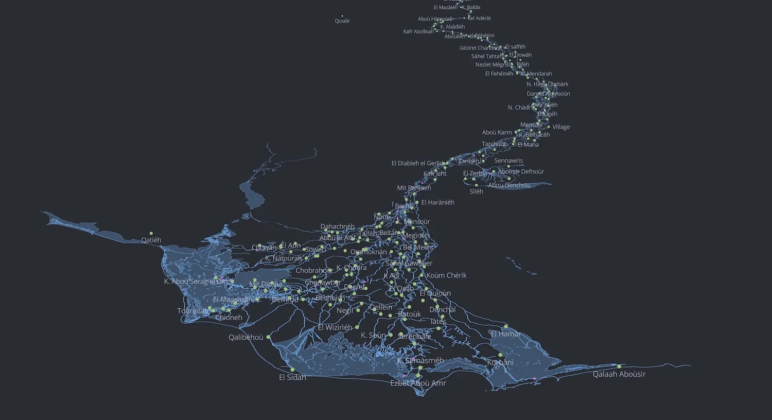
The production of digital geographic data from historical sources with the help of GIS (Geographic Information Systems) methodologies has been one of the most important objectives of the Digital Archaeology Laboratory (LAD) at Sapienza University of Rome for several years now. With this in mind, starting in 2019 and in collaboration with the ERC PAThs project, LAD began taking its first steps in the study of the Carte topographique de l’Égypte, an 1828 publication by the French engineer Pierre Jacotin, considered a significant tool for the reconstruction of the ancient Egyptian landscape. Indeed, the Egyptian landscape has undergone many changes over the centuries, and this cartographic series (there are 47 sheets pertaining to Egypt) can be used as an informational bridge between the present and the past. Building on this premise, over the past few years LAD, with the invaluable help of Sapienza students, has focused first on georeferencing the cartography itself, then on vectorising the hydrographic network shown on the map, and finally on creating a georeferenced gazetteer of eighteenth-century Egyptian place names. The data resulting from the completion of these projects have been published in open access in the data repository of the PAThs project docs.paths-erc.eu/data, in a dedicated repository (github.com/lab-archeologia-digitale/jacotin-1828), and, finally, in scientific journals (see the list of publications below).
In the coming years, LAD will continue the process of vectorising the map in an effort to increase the amount of geographic data extracted from it. Among the most immediate objectives are, for example, the vectorisation of the road network and of the kom shown on the sheets.
Publications
- Bogdani, Julian, D’Erasmo, Domizia, de Leone, Cecilia and Giordano Arianna. 2022. “Digitising the Napoleonic map of Egypt. The creation and publication of an open data set for the recontruction of the ancient egyptian landscape”. Vicino Oriente XXVI: 77-97. DOI: 10.53131/VO2724-587X2022_5.
- D’Erasmo, Domizia. 2019. ‘Georeferencing Napoleonic cartography to reconstruct ancient Egypt landscapes: methods in comparison and the case of the island of iw-rd in the 16th nomos of Upper Egypt’. GROMA 4: 1–19. DOI: 10.12977/groma22.
Conference and workshop presentations
- 2022/09/23: Archeo.FOSS XVI | 2022. International conference on Open software, hardware, processes, data and formats in archaeological research
Presentation title (Julian Bogdani, Domizia D’Erasmo): Backward engineering historical maps: the case of 18th century gazetteer of the Napoleonic map of Egypt - 2022/03/21: Workshop of the RDR Lab (Laboratorio di Risorse Digitali per la Ricerca) organised by Federica Favino and Julian Bogdani within the framework of the PhD programme in History, Anthropology and Religions (SAR) at Sapienza University of Rome.
Presentation title (Julian Bogdani and Domizia D’Erasmo): Il sistema GIS della cartografia napoleonica d’Egitto: nuovi dati per la ricerca storica e archeologica. - 2020/11/25: Workshop titled “Da Napoleone al WebGIS: metodi ed esperienze di datificazione di cartografia storica” within the framework of the Digital Humanities course at Sapienza University of Rome (with Julian Bogdani, Domizia D’Erasmo, Paolo Rosati, Cecilia De Leone, Arianna Giordano and Luigi Campagna).
Online resources
- Open-access Napoleonic cartography published on the David Rumsey Map Collection cartographic portal:
https://www.davidrumsey.com/luna/servlet/view/search?q=pub_list_no%3d%223964.000%22 - Georeferenced Napoleonic cartography, open access, in GIS XYZ format, published on the PAThs data portal, curated by LAD:
https://docs.paths-erc.eu/data/#jacotin-1827 - GitHub repository curated by LAD with the vector GIS data processed to date for the Napoleonic cartography:
github.com/lab-archeologia-digitale/jacotin-1828 - WebGIS preview of the vectorised Napoleonic cartography, curated by LAD:
lab-archeologia-digitale.github.io/jacotin-1828/