


We are happy to announce the release of DirectusImporter, a plugin developed by the Digital Archaeology Laboratory (LAD) at Sapienza to simplify and automate the integration of data stored in Directus into QGIS.
The plugin was designed to support day-to-day work in the field and in the lab, making it possible to view and query, directly within a GIS environment, the information collected and managed through our backend on Directus.
The plugin’s source code is available on GitHub at:
🔗 https://github.com/lad-sapienza/DirectusImporter and is released under the GNU GPL 3 license.
What is DirectusImporter?
DirectusImporter is a QGIS plugin written in Python that allows you to:
- connect to a specific Directus instance configured as the geographic data backend;
- query a Directus collection that contains geometries;
- download and display the features as layers in QGIS;
- access the metadata and custom fields defined in the CMS.
The plugin is designed to be easily adaptable to different projects and fits perfectly with the open source philosophy that characterizes the tools used by LAD.
How it works
Once the plugin is installed (see instructions on GitHub), you can:
- Configure access to a specific Directus instance by providing the API URL, the collection to query and an authentication key (token).
- Load the data with a simple click, obtaining a vector layer in QGIS updated with the data contained in Directus.
- Explore the attributes directly from the QGIS attribute panel, including any images, links and complex values.
Why use it?
In our day-to-day work, Directus is often used to manage heterogeneous and complex archaeological data: stratigraphic units, photographic documentation, information from laser scanning and photogrammetric surveys. Bringing this information into QGIS without manual conversions or intermediate exports represents a considerable advantage in terms of efficiency, data consistency and real-time updating.
This plugin was therefore born as a concrete response to operational needs encountered in our field projects, particularly in Albania and Greece, and is meant to be shared as a contribution to the scientific community that adopts open source solutions.
Screenshots
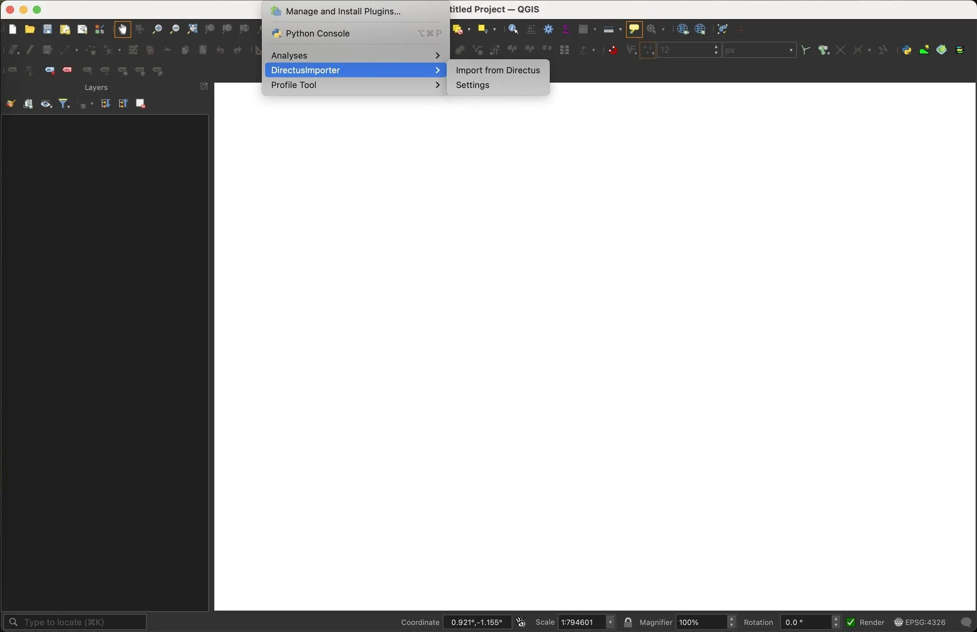 Starting the plugin in QGIS.
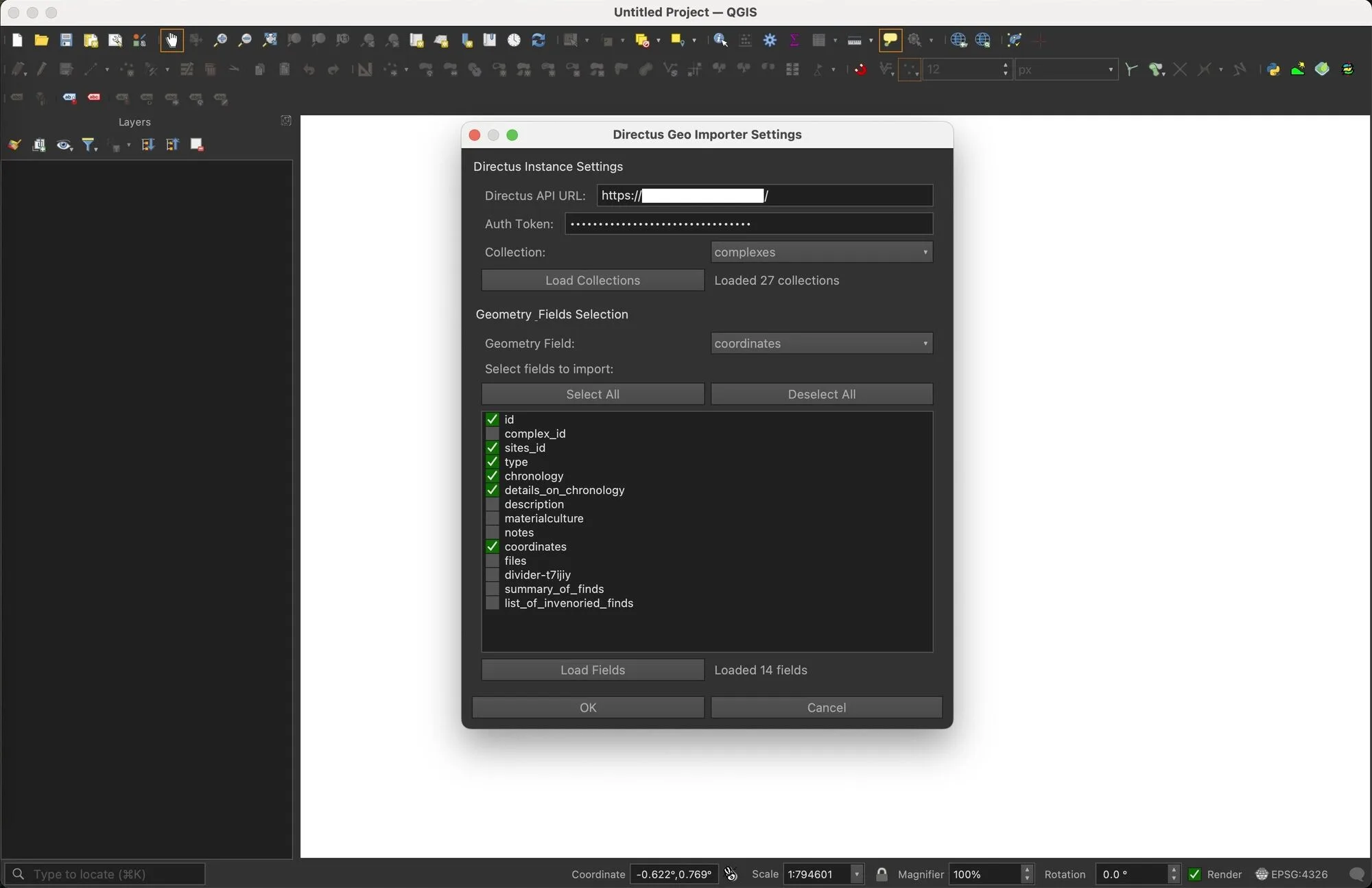 Configuration interface of the DirectusImporter plugin with the connection parameters for the Directus instance.
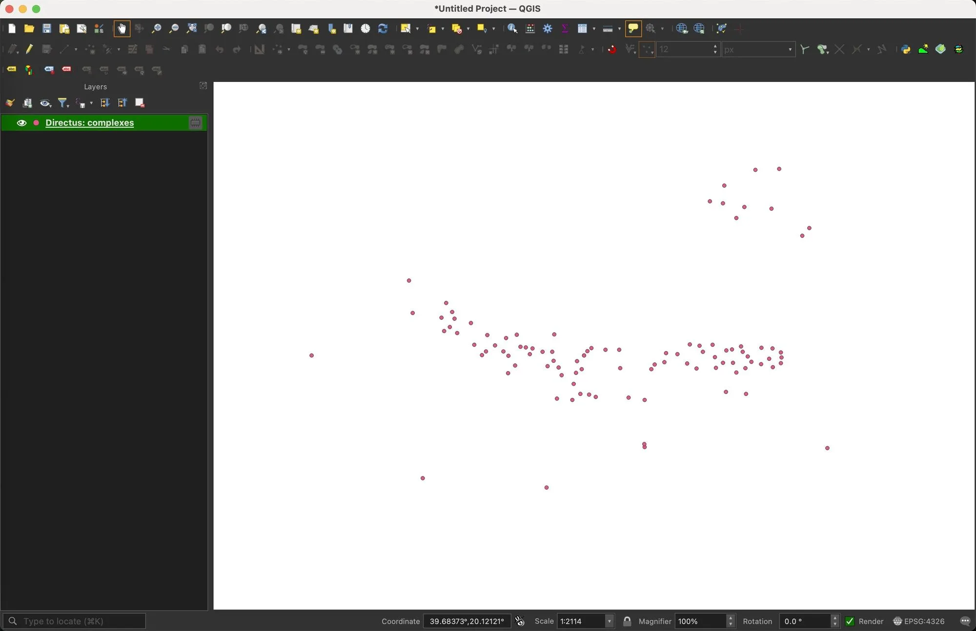 A vector layer loaded in QGIS directly from a data collection managed on Directus.
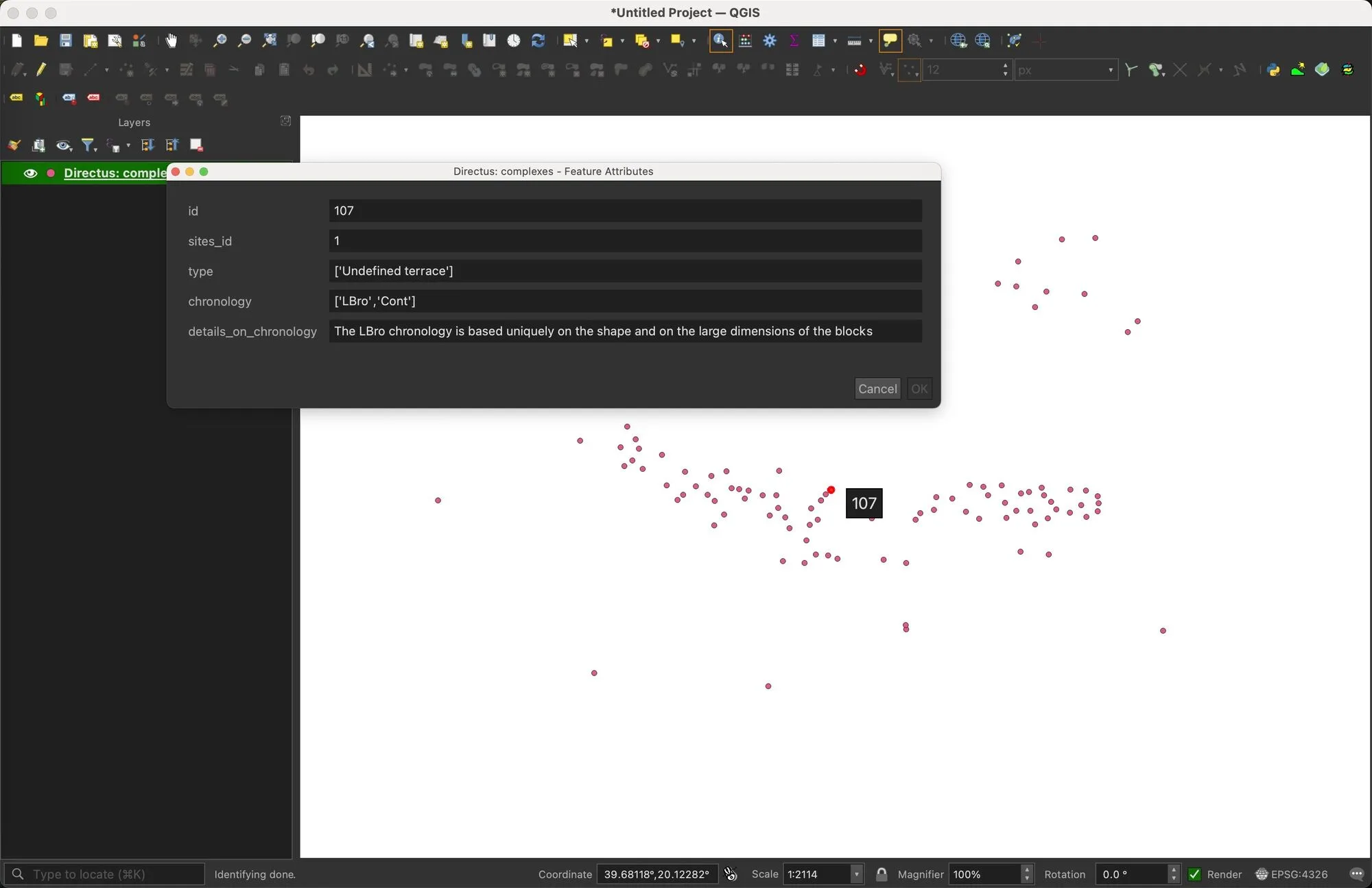 Display of attributes coming from Directus, including metadata and links to multimedia content.
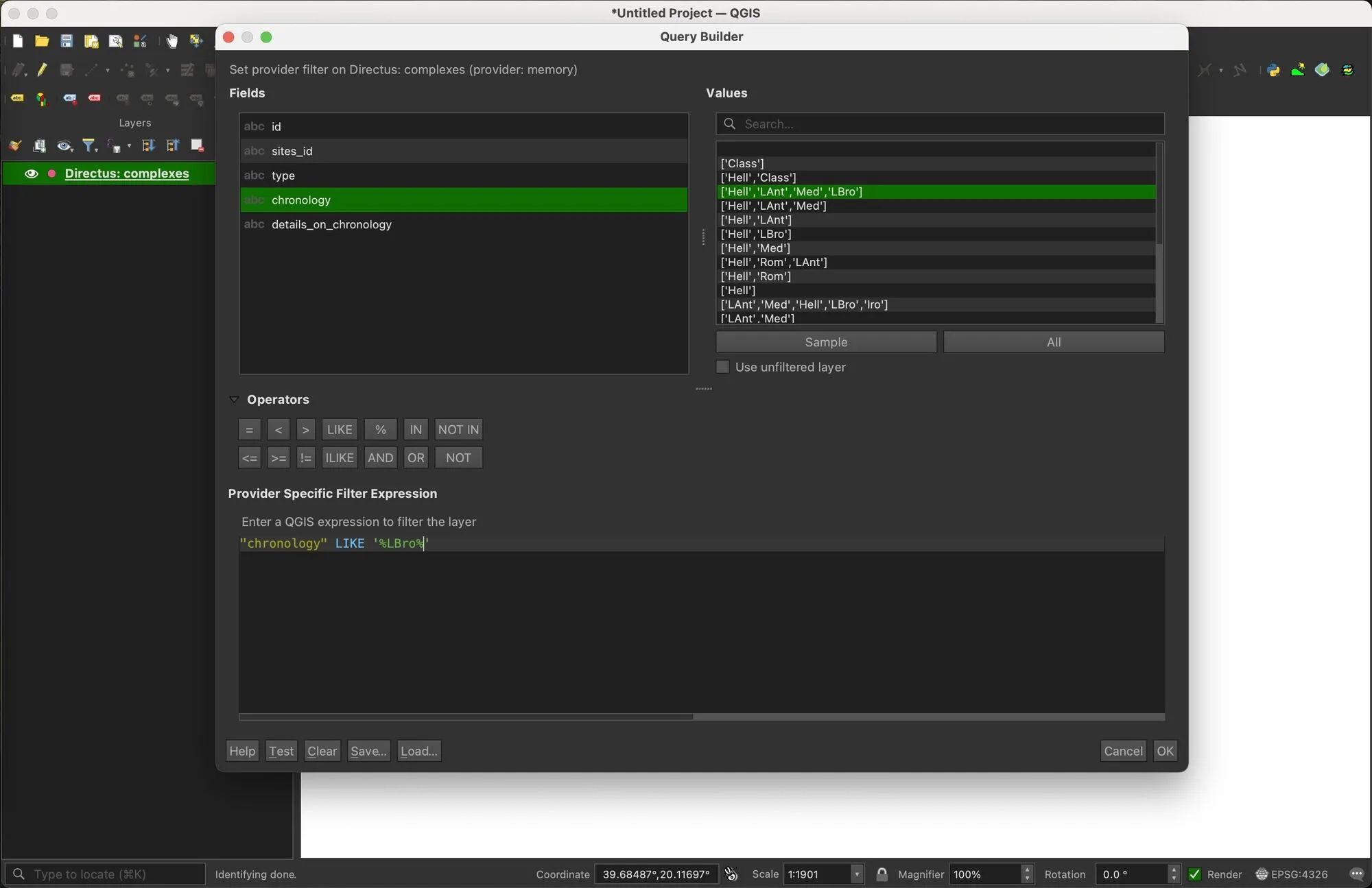 Filter interface using QGIS’s Query Builder system
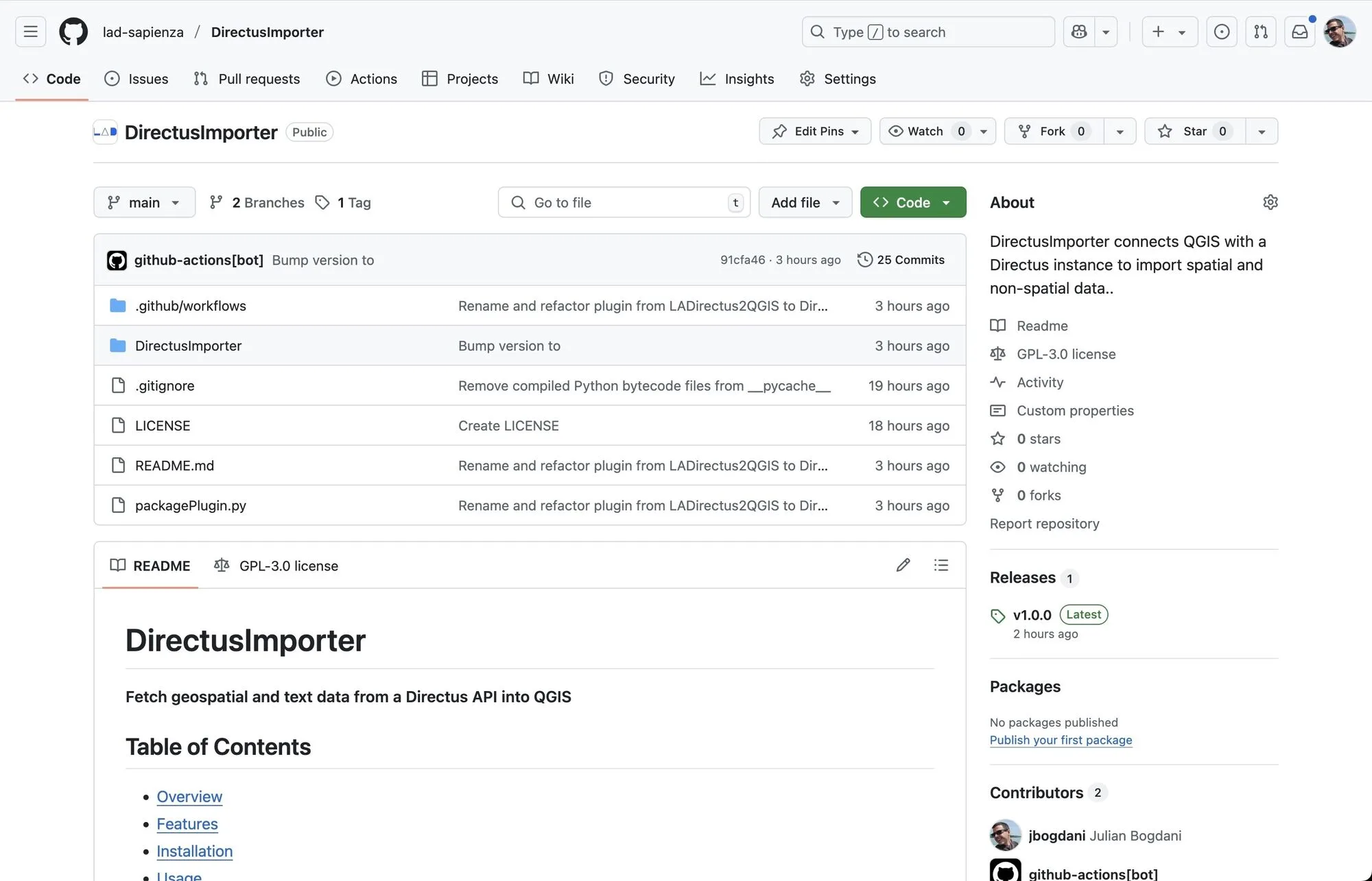 The homepage of the GitHub repository from which you can download the plugin and consult the documentation.
Try it and contribute
The plugin is under active development: field-testing it and gathering feedback is an integral part of the process. Anyone who wants to try it is invited to download it from the GitHub repository and to report any issues or suggestions via the issue tracker.
For any questions or further information, you can contact us directly through the LAD website or write to: julian.bogdani@uniroma1.it.